Professional Borehole & Groundwater Services
Our Services
Groundwater Location Study
A groundwater location study is a process used to find the best place to drill for underground water. It helps identify where water is most likely to be found beneath the ground and how deep it may be.
Special tools and scientific methods are used to study the soil and rock below the surface. This shows how water moves underground and where it is stored.
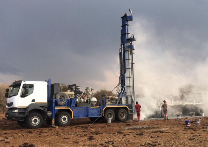
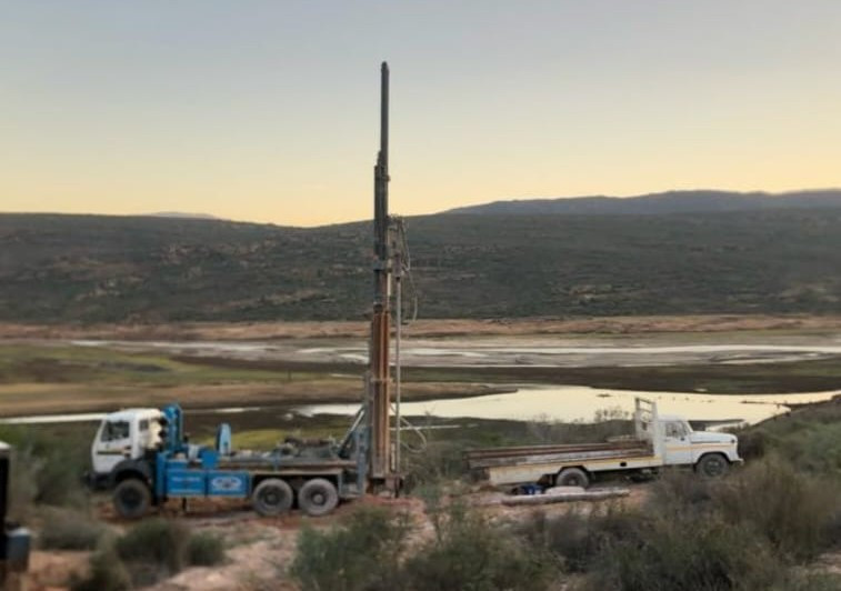
Borehole Drilling
Comprehensive hydrogeological assessments to identify and characterize groundwater resources.
Boreholes are a reliable water solution for homes, farms, businesses, and communities, especially in areas where no municipal water is available.
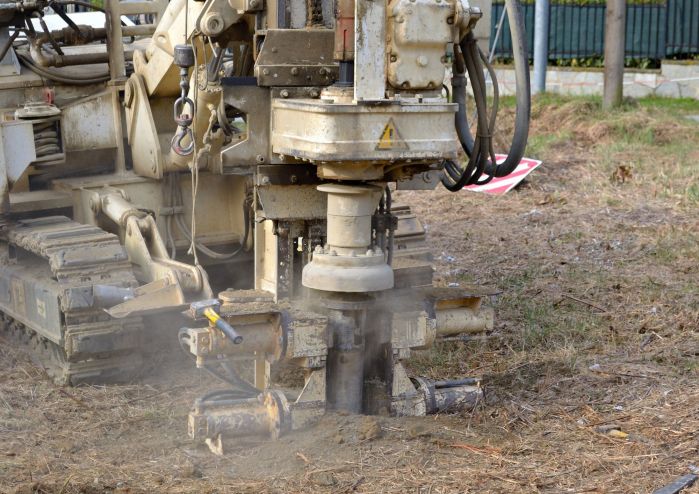
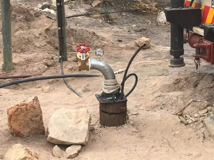
Borehole Installation
Complete installation of pumping systems, casings, and related infrastructure for efficient water extraction.
Proper borehole installation ensures clean water, good water flow, and long‑term reliability. It is a critical step in making sure the borehole functions efficiently and lasts for many years.
Borehole Testing
Comprehensive testing including yield tests, water quality analysis, and system performance evaluations.
Geological Water Surveys
Detailed geological assessments and water resource mapping for sustainable water management.
Dam Surveys
Detailed site inspections, capacity assessments, and structural evaluations to ensure safe, efficient, and sustainable dam design and management.
About Us:
At SGS Water Solutions, we believe that access to clean, reliable water is the foundation of sustainable living and development. With years of experience in borehole testing, surveying, drilling, installation, and water siting, we provide end‑to‑end solutions tailored to the unique needs of each client.
Our team combines technical expertise with a deep commitment to quality, ensuring that every project is carried out with precision, safety, and respect for the environment. From the first survey to the final installation, we deliver services that meet regulatory standards and exceed client expectations.
We take pride in being more than just a service provider — we are partners in helping communities, businesses, and households secure dependable water resources. Whether you need a new borehole, maintenance of an existing system, or expert guidance on water siting, SGS Water Solutions is here to support you every step of the way.
Our services cover the full spectrum of borehole development: site selection, geological surveying, drilling, pump installation, and regulatory submissions. Using advanced remote sensing and moisture analysis, we ensure precision, efficiency, and compliance at every stage.
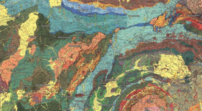
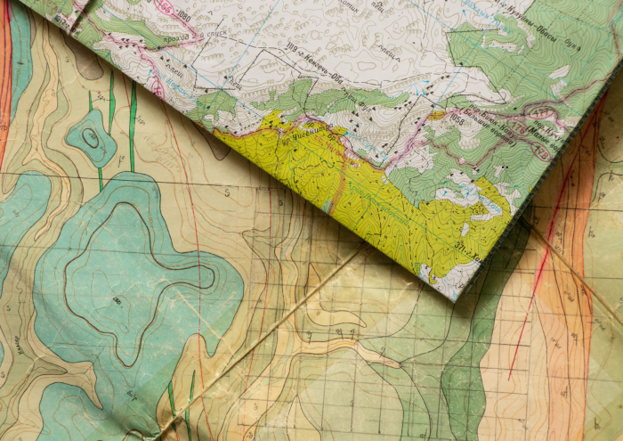
Geological Mapwork
Geologic maps highlight contacts, fractures, and fault lines — all key indicators of water movement underground.
Contacts: Where two rock formations meet
Fractures: Cracks formed by fault activity (shown as black lines)
Fault lines: Shifts in tectonic plates (shown as dotted lines)
These features create openings where water flows under high pressure, with the surrounding formations determining whether the static water pressure is high or low.
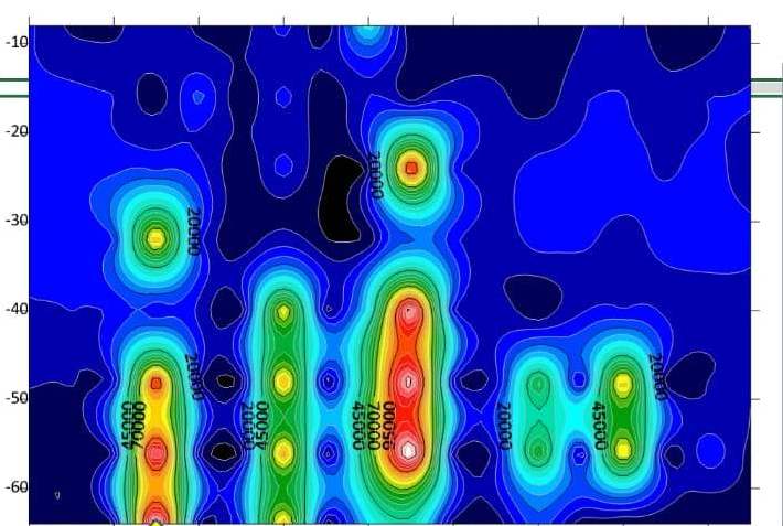
FDEM
This machine uses Hertz (Hz) measurements to assess how porous the soil is. The more weathered the ground, the greater the chance that water can flow through.
On the chart, the arrow highlights the best drilling point — a broad area along a fault line with high weathering. This spot is highly porous, making it a strong indicator of water presence.
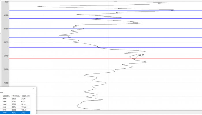
ESU (Electro Seismic Unit)
This machine uses ultra‑sensitive nano‑volt impulses to reveal whether a borehole carries water.
Graphic signals show soil movement and formation changes.
Ruffles in the lines indicate water or dampness in the ground.
A ruffled signal is a strong sign that the borehole has good water potential.
Gallery
Contact Us
At SGS, we specialise in professional borehole services and are ready to assist you every step of the way. Whether you need help locating water, planning a borehole, or improving your drilling success, our experienced team is here to guide you.
We understand that every site is different, which is why we take a tailored approach to each project. Our goal is to help you avoid costly dry boreholes and ensure the best possible results.
Getting in touch is easy – simply contact us via phone or email, and we’ll gladly discuss your needs and recommend the best solution for your borehole project.
Don’t hesitate to reach out – we look forward to working with you.
Get in Touch
Contact Information
Chrizelle Velloen:
Tel: (+27)69 392 9805
Email: chrizelle@sgswater.co.za
Adriaan Janse van Vuuren :
Tel: (+27)67 872 0970
Email: adriaan@sgswater.co.za